The Cultural and Hydrological Heart of the Upper Elbe
Rising gracefully from the gentle loops of the Elbe river valley, Dresden holds an iconic position in European cartography and architectural heritage. Known historically as "Elbflorenz" (Florence on the Elbe), the city reflects an extraordinary harmony between natural riparian meadows and monumental Baroque sandstone architecture.
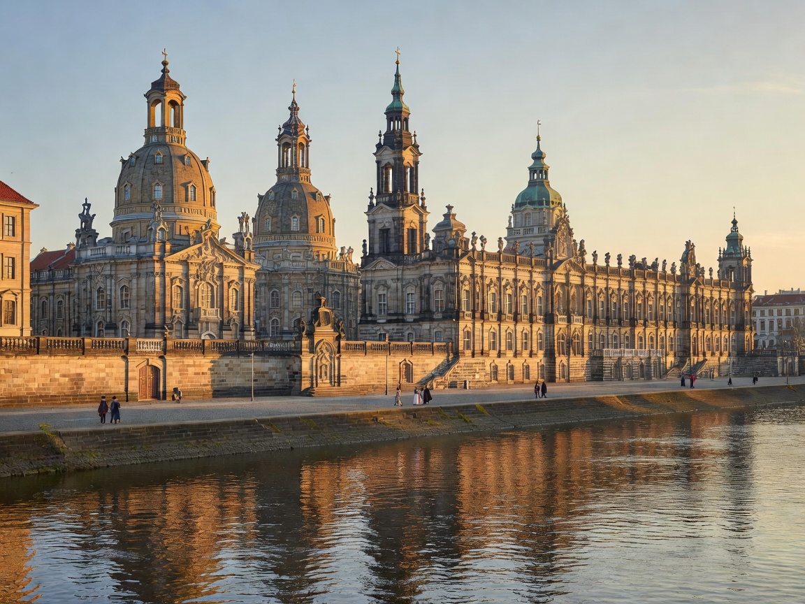
Brühl’s Terrace: The Balcony of Europe
Constructed on the remnants of the city's sixteenth-century fortress ramparts, Brühl's Terrace elevates visitors above the high-water line of the Elbe. It offers commanding vistas across the river corridor toward the Loschwitz hillside vineyards and the downstream floodplains. Below the terrace, the world’s oldest and largest fleet of historic paddle-wheel steamers (the Sächsische Dampfschiffahrt) continues to operate, navigating the river reaches between Meißen and Bohemian territory.
"The river gives Dresden its rhythm, reflecting the sandstone cupolas by sunrise and carrying trade and steamship travelers across three centuries of documented European navigation."
Engineering and River Crossings
The crossing points in Dresden provide critical insights into nineteenth and twentieth-century civil engineering:
- Augustus Bridge (Augustusbrücke): The historic heart of urban crossings, built in sandstone to withstand high seasonal flood surges while preserving views of the Catholic Court Church and the Semperoper.
- Loschwitz Bridge ("Blue Wonder" / Blaues Wunder): Completed in 1893, this cantilever truss bridge was an engineering marvel of its era, constructed without river piers to ensure unimpeded river vessel clearance.
- Waldschlößchen Bridge: Modern four-lane crossing engineered with low structural profiles across the wider meadow plains.
Hydrological Flood Management
Following historical high-water events in 2002 and 2013, Dresden implemented one of Europe's most advanced integrated floodplain management systems. Wide inundation meadows (Elbwiesen) flanking both riverbanks are strictly preserved as green belts, allowing peak discharge volumes to disperse without threatening the historic Altstadt cores.